Mapi is our free GIS web map viewer.
Go to Mapi
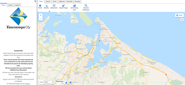
The image below shows what Mapi looks like.

Benefits of Mapi include:
- Effortless experience: We’ve revamped the interface for a smoother, more intuitive user experience.
- Improved features: Enjoy upgraded functionality, enhanced security features and access to the latest 2024 aerials.
- Export functionality: You can export your data to various drawing file types, including popular formats like CAD and Shape, for seamless integration with other programs.
- Get sharing link: Sharing of specific location, including any layers you have turned on to yourself or others.
- Collaborative advantage: Other councils, including Western Bay, are also upgrading their systems to this new version, which makes using GIS tools across the Bay of Plenty a breeze.
Try out Mapi here with a useful guide and map legend below.
Mapi user guide (1.4mb pdf)
Mapi Legend (577kb pdf)
If you have any concerns or difficulties with Mapi, please email gis@tauranga.govt.nz